MY BLOG ON MOUNTAINEERING, ICE & ROCK CLIMBING, SKIING, KAYAKING, TREKKING AND SCIENCE
Thursday, July 31, 2008
A day at Kullen, Sweden
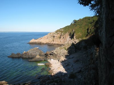
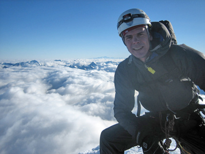
The climbing crag which is closest to my home in Copenhagen is Kullen/Kullaberg, Sweden. It is located in the most beautiful setting with cliffs going directly into the ocean. No matter where you climb in the area you thus have an excellent view!
A typical scenery at Kullen - rocks with a view!
This Sunday I went climbing there for the first time this season with Camilla Hylleberg. We had a great day in perfect weather and climbed five routes. First I led Papillon (IV+) which was a great 2-star route which however, was a bit exposed for a first trad lead of the season! Next Camilla climbed Flagermusen (V+), which was also a great 2-star route although it was a bit of a sandbag at that grade! Great lead of Camilla who, in contrast to me, was in great trad climbing shape after a 3-month climbing trip to Chamonix and USA!
Camilla leading Flagermusen (V+).
Next we climbed two other 2-star routes, Nirvana (V+) and Samsara (V+), which were also excellent. I was quite satisfied to lead V+ on my first trad-day of the season and slowly my head was mentally getting back into the game of leading on the suspect rock of Kullen.
Camilla following on Nirvana (V+).
Kullen is notoriously known for its loose rock and you thus have to be extra careful placing gear and pulling on blocks!
Camilla leading Samsara (V+).
That said, the four routes we had climbed so far had been on solid rock (thus the two stars), and maybe that was the inspiration for my next route Skidtrenden (V-) [translates to "The Shit Groove"] which turned out to live up to its name!
Camilla following on Skidtrenden (V-) with another loose hold in her hand.....
Several holds on the upper half of the route were loose, and it thus had an alpine feel to it! Well, great training for the next alpine climb....
Camilla rappellingSkidtrenden, which is the chimney line left of her.
It was actually still an enjoyable climb and in particular the squeeze up the upper chimney was fun. In my view, the route thus didn't quite deserve the negative smiley in the guide book.
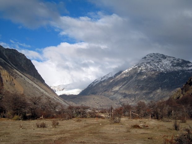
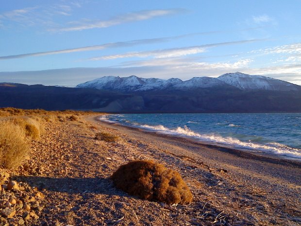
So far the weather in Patagonia had been perfect and we were thus anxious to get going. The day after our arrival at PuestoMuñoz the weather continued to be perfect and we thus packed our tent and climbing gear and walked up to the end of the Rio Oro valley to set up an advanced base camp (ABC).
Carlos crossing the rocky river bed on the approach to the Rio Oro valley. The left side of the moraine front is seen above his head.
The first obstacle was a hill made by the moraine front which was easy to cross via an old path marked with cairns. We stayed right of the Rio Oro all the way to the end of the valley in which way we avoided to cross the river by foot.
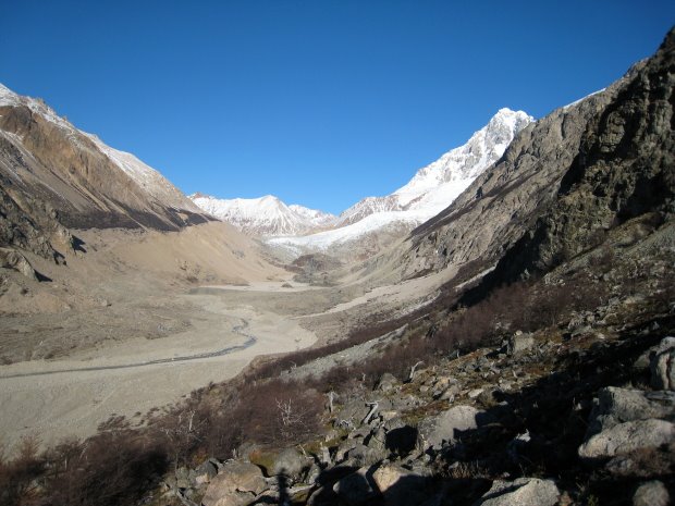
View of the Rio Oro valley from the top of the moraine hill. Summit of Cerro San Lorenzo is seen in the background.
Except from a couple of big slab boulders we had to pass, the terrain was easy to navigate and we eventually were able to walk from PuestoMuñoz to ABC in just 2.5 hours.
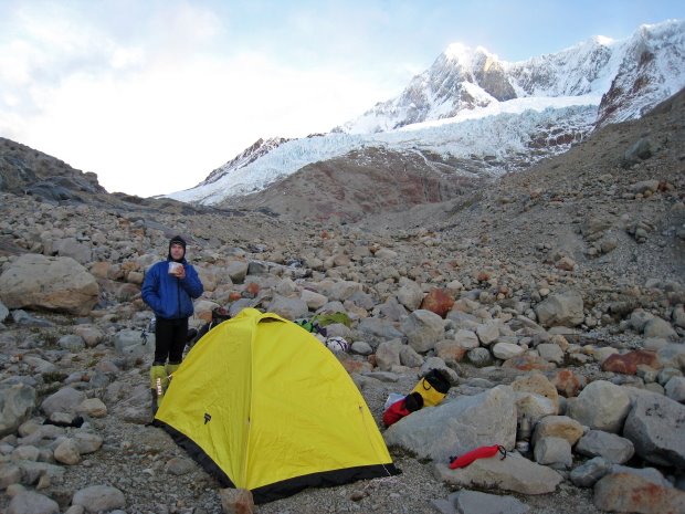
We found a perfect spot for the tent - an amazingly flat square surrounded by millions of rocks. How is that even possible!?
Carlos at the ABC at the end of the Rio Oro valley and at the base of the mountain. Cerro San Lorenzo is seen in the background.
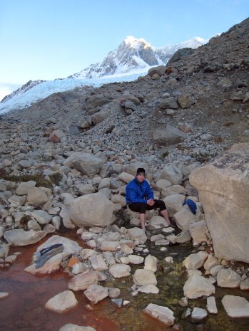
The ABC was located next to a hot spring which according to the Sar family is the only one in Patagonia! It was really nice to wash our feet in the warm water after walking in our hot 8000 meter mountain boots! After our first night in the ABC we learned that the ground under the tent was also hot which provided a heated floor! What a luxury!
Carlos enjoying the hot springs. Amazingly, the water had two different temperatures: the green and red side was ~40 °C and ~80 °C, respectively!
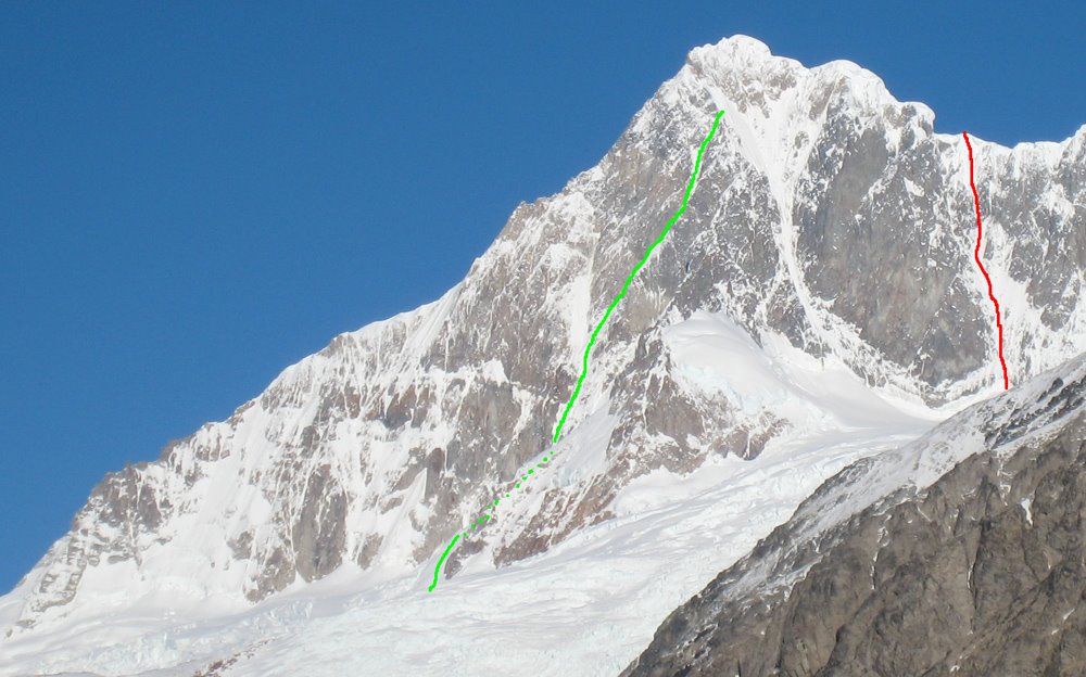
We spent a while spotting potential routes and found two unclimbed routes being of particular interest: a snow ramp/couloir going up the North-East face (shown in green below) and a snow couloir with a steep ice section going up the Northern East face (shown in red below):
Potential new routes on the North-East (green) and Northern East (red) faces of Cerro San Lorenzo.
Albeit the North-East face route looked great it looked very difficult a the top where we would have to connect to the East ridge somehow. In the end we thus decided to aim for the Northern East face route, which also looked great as it had a narrow & steep (AI5?) ice section.
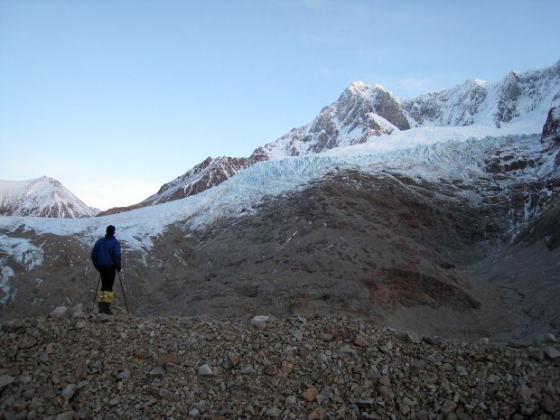
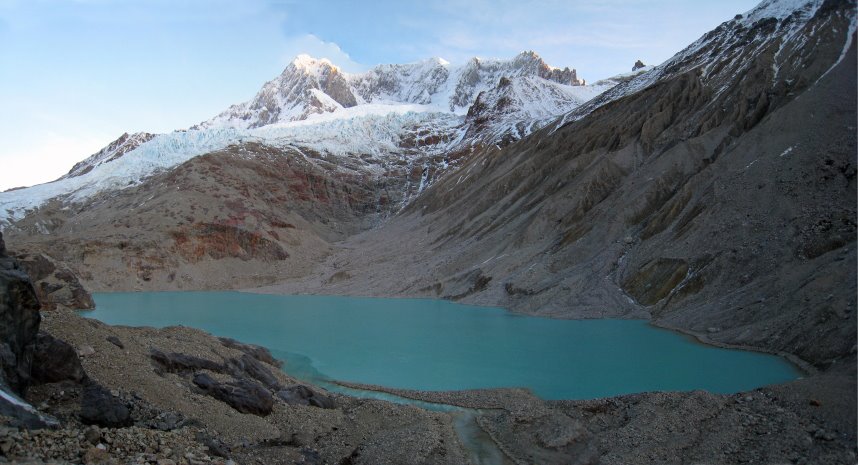
On a later trip to the ABC we explored how to get onto the glacier from the ABC. It was quite clear that the glacier had receded a lot in recent years as the front was now quite high up compared to our map - and it had even created a new lake in the valley! Basically we were left with two options:
Option 1: continue up the valley to polished slabs (seen behind Carlos), which would take us to the East ridge / North-East face via a heavily broken glacier.
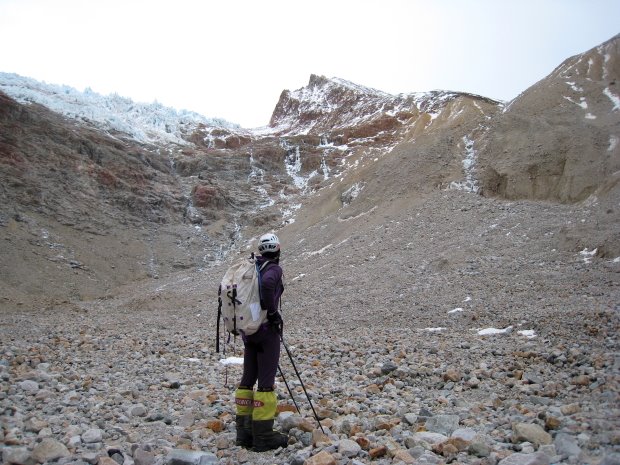
Option 2: go around the lake on the right (North) side and walk up the valley seen in the middle of the picture. At the end of the valley it looked as if we could climb up a ravine towards the right to reach a col high up on the glacier. Due to steep rock going directly into the lake it was not possible to go around the lake on the left (South) side.
None of the options were perfect as the slabs were exposed to ice fall and the North side of the lake was exposed to rock fall. Luckily, the cold temperature seemed to keep the ice and rock fall to a minimum, but neither place would probably be fun to cross in the summer!
Due to lots of crevasses and the lack of snow on the low part of the glacier it seemed very difficult to pass, so in the end we decided to try Option 2 as it looked as it would take us high up on the mountain before we had to get on the glacier - hopefully we would find easier terrain up there.....
Carlos looking up at the ravine at the end of the valley behind the lake.
After dumping our stuff at the ABC we walked back to PuestoMuñoz and started to make plans for our ascent of the mountain. We were totally excited by the easy approach to the foot of the mountain, the new route potential and the great weather. Unfortunately, the latter changed the next morning, which left us with warm (i.e. around freezing point) and unstable weather for the following +2 weeks......
The mountain engulfed in clouds. After a cold and stable start, we got +2 weeks of warm and unstable weather which locked us in Puesto Muñoz.
"Let's go to Patagonia and climb in the winter!?" - my friend Carlos Buhler and I were looking for a June project and now I thought he had lost it! Having read countless stories about bad weather in the summer I could hardly imagine how miserable it would be in the winter. But in the end he convinced me that the weather would be more stable, albeit colder, in the winter and taking his word for it I bought an airline ticket to Buenos Aires.
Next we discussed what to climb, and based on recommendations from Pere Vilarasau, Rolo Garibotti and others (and the fact that Carlos had already climbed Cerro Torre in the Fitz Roy park) we decided to go to Cerro San Lorenzo (3706 m) some 500 km north of Fitz Roy. San Lorenzo is a very interesting peak as it has seen much less traffic than its Southern cousins. So far only four different routes have been established:
the Agostini (normal) route from the Chilean side [largely a non-technical ski touring route]
the East ridge (a.k.a. the South African Route)
the North Face couloir (with two variations at the top)
a route via the Western Glaciar calluqueo and the South summit (has not been published in detail yet [August 08])
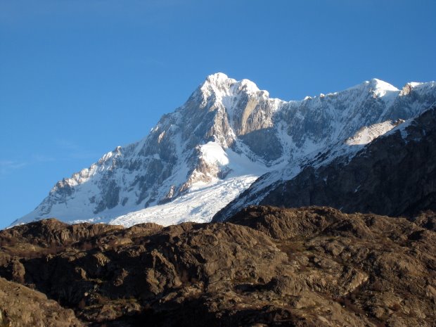
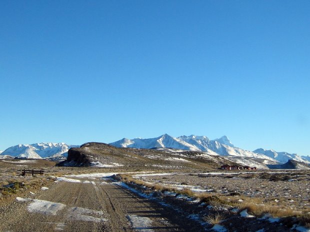
Cerro San Lorenzo seen from Puesto Muñoz with the East ridge (left) and North Face couloir (middle) clearly visible.
It took us a while to gather information about the mountain and the routes but eventually found the following descriptions:
SummitPost.org [a comprehensive description of the mountain with particular focus on the normal route]
AAJ 1987 [click to download PDF file describing the FA of the East ridge]
AAJ 1988 [click to download PDF file describing the FA of the North Face]
AAJ 2005 [click to download PDF file describing the first winter ascent of the normal route]
AAJ 2006 [click to download PDF file describing a variation to the North Face route with a direct finish]
In addition we got pictures of the East faces from Doug Tompkins and Michael Kennedy (thanks!) which together with the descriptions listed above convinced us that there was a huge potential for new mix routes on the Argentinean (East) side of the mountain.
From the descriptions it was also clear that access to the mountain from the Argentinean side is not trivial. Basically, you can approach the mountain from the North-West (the normal access from Cochrane, Chile), the North-East (leaving Route 40 at Bajo Caracoles, Argentina and drive East to Lago Posadas via Route 39, then continue to Estancia Los Ñires and then follow Rio Oro to Puesto Muñoz), and the South-East (leaving Route 40 just North of Las Horquetas, Argentina and drive East to Parque Nacional Perito Moreno which you cross to enter Estancia El Rincón (owned by Doug Tompkins)).
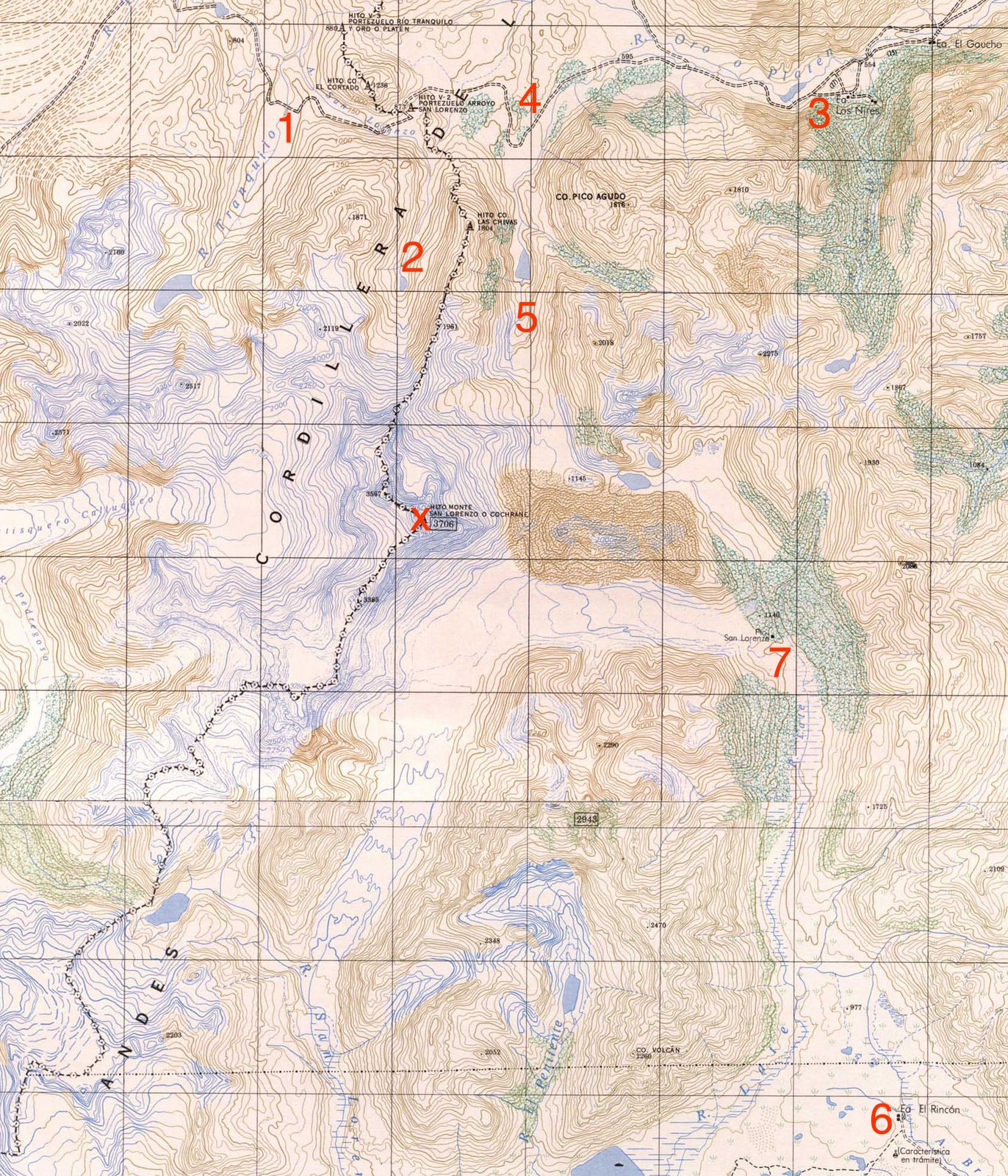
Map of Cerro San Lorenzo with the following waypoints: 1. The approach "road" from Cochrane. 2. The Agostini hut - base camp of the normal route. 3. Estancia Los Ñires. 4. Puesto Muñoz. 5. Our ABC with hot springs. 6. Estancia El Rincón. 7. Puesto San Lorenzo (a basic hut owned by Doug Tompkins which has been used by previous climbing parties as shelter). x. Summit of Cerro San Lorenzo.
Click picture to enlarge.
Some of the descriptions had warned of difficulties getting permits from the land owners on the Argentinean side to access to the mountain and in addition it was clear that we would need a 4x4 to have any chance of getting within walking distance of the mountain. However, Doug Tompkins had given us permit to cross his land (Estancia El Rincón) and Sebastian Letemendia had put us in touch with Mario Sar (the owner of Estancia Los Ñires and PuestoMuñoz). We thus felt confident that we somehow would be able to get to the southern or northern East face from the Argentinean side.
After a lot of research on price of 4x4 rentals and domestic airfares we decided to rent a 4x4 (Nissan X-terra2) in BuenosAires and then drive the ~2500 km in each direction to the mountain! Renting 4x4's in Argentina is not cheap, but AbCars had the best deal we could find and they turned out to be trustworthy and efficient. Based on recommendations from Tommy Heinrich we stocked up with 2 x 20 liter jerry cans, 2 spare tires and snow chains. Seemed a bit extreme and as it turned out we only needed one of the spare tires - but better safe than sorry (on average there was 200 km between gas stations in Patagonia). Also we purchased gas canisters and all our groceries in BuenosAires as we were not sure what would be available down south.
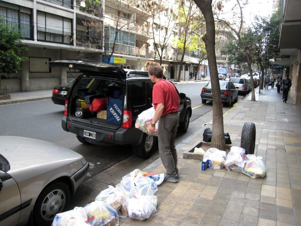
Carlos loading the 4x4 with gear and groceries.
After two days of buying stuff in Buenos Aires we finally started driving south. After just 200 km we were stopped in the first (of many) police controls. They claimed that we needed an international drivers license to drive in Argentina (which I had left at home...) and thus wanted to give us a fine. However, we didn't buy their B.S. and thus called Veronica at the rental company who talked to the police officer twice after which he finally gave up and let us go - thanks Veronika for straightened them out! We later learned that a typical fine in Argentina is 3-5 US$ and has more character of a bribe than a fine - the government will never see any of that money.....
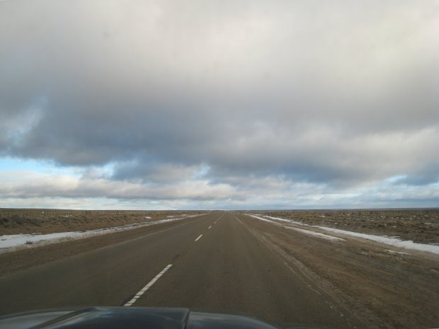
Most of the trip down south looked like this - straight roads on flat pampas.
We drove down Route 3 which follows the Atlantic ocean all the way to Ushuaia in the extreme south. At Caleta Olivia we turned inland on Route 12 leading us to Route 43 which took us to the town Perito Moreno. Driving on the pampas was pretty event less besides the occasional police controls (which except from the first one gave us no problems - it helped a lot to pretend not to speak Spanish!) and three road blocks by striking oil workers around Comodoro Rivadavia and Caleta Olivia. Luckily they only stopped cars for ~30 min so it was not too bad.
Movie passing one of the road blocks.
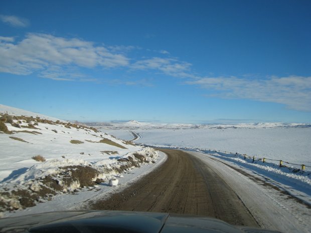
As we approached the Andes mountain chain, the scenery got much more beautiful and in Perito Moreno we turned south again on the legendary Route 40 (a partly gravel road, being paved now, following the Andes mountain chain throughout Argentina).
Route 40 - which is partly a gravel road.
We first tried the Southern access and after 3 1/2 days of driving we got to Estancia Menelik situated just outside the Parque Nacional Perito Moreno where we spent the night with the caretaker Manuel Pedro (thanks to the owners, Rafa & Augustin Smart, for given us permit to stay there!).
Estancia Menelik with the South-East faces of Cerro San Lorenzo in the background.
The next morning we continued to the park office (~100 km from Route 40) and spoke with the park rangers. They were quite surprised to see us, as no "normal" people visit the park in the winter! The first ranger we spoke with (named Fernando) was friendly although he claimed that the dirt road to Estancia El Rincón was closed by snow drifts (which was hard to believe given the low amount of snow at the park office!). Suddenly a second park ranger (named Leo Montenegro) appeared who was a lot more aggressive and unfriendly. He didn't want our 4x4 on park grounds as he was afraid our SUV would get trapped for months if we got a snow storm and he got blank eyes when we told him of our intentions to stay on Doug Tompkins land for almost a month climbing steep routes on the mountain. Suddenly the park was closed for the season, and he would report us to the police if we drove into the park etc. After a lot of negotiations he offered to drive our stuff to Estancia El Rincón (but no further, which left us with 19 km walking to get to Puesto San Lorenzo with all our gear and food) and they would then drive the car back to Estancia Menelik. Having us out of the park would leave him with clean hands if something happened - I just love park rangers and national parks.....
The entrance and park office (middle right) of Parque Nacional Perito Moreno with Cerro San Lorenzo in the background.
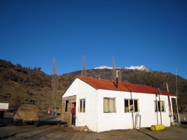
Not liking the prospect of carrying all our gear and food 19 km just to get to Puesto San Lorenzo (from where there would be another ~7 km to the foot of the mountain), we decided to try the Northern access before we made a final decision on our approach. We thus drove back to Bajo Caracoles where we met Mario and Mari Sar - the owners of Estancia Los Ñires and Puesto Muñoz. In contrast to the 2006 AAJ description (which reported that the Sar's allegedly had charged 1200 US$ per person to cross their land) we found the family to be extremely friendly. Mario Sar thus guided our SUV all the way to Puesto Muñoz and let us stay in the new house they were building there for just 300 US$ total!
The gravel road (Route 39) to Lago Posadas was of high quality and the dirt road to Estancia Los Ñires was also pretty good (collectively 130 km from Route 40 to Los Nires).
The spectacular natural dam between Lago Posadas and Lago Pueyrredón.
However, the 15 km from Estancia Los Ñires to Puesto Muñoz was a mix of a rough track and a rocky river bed with several river crossings, which would have been impossible to navigate without a guide! As we got to Estancia Los Ñires in the dark we decided to spend the night there and then continue the next morning.
Mario Sar enjoying the morning sun hitting Estancia Los Ñires.
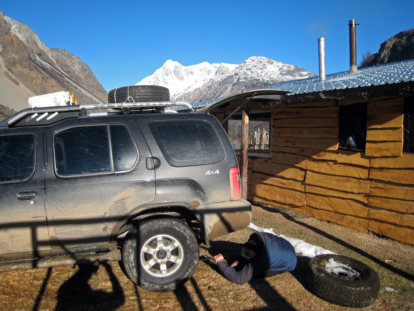
It was an exciting ride the next morning - in particular the river crossings were a bit unnerving. Luckily, Carlos has a lot of experience of driving in this kind of terrain from climbing in The Ghost, Alberta, Canada and he thus got us safely to Puesto Muñoz with just one flat tire ;-)
Video of one of the river crossings guided by Mario Sar.
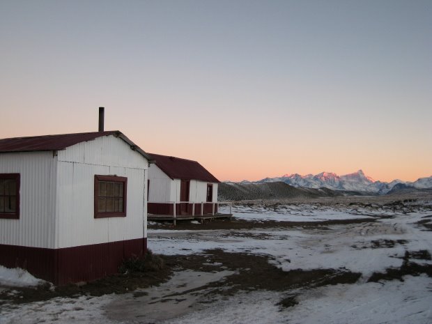
We were totally psyched when we got to Puesto Muñoz - it was close to the mountain and there was a new hut with a stove. The perfect base camp!
Changing the tire at Puesto Muñoz. Note the close proximity to the mountain :-)
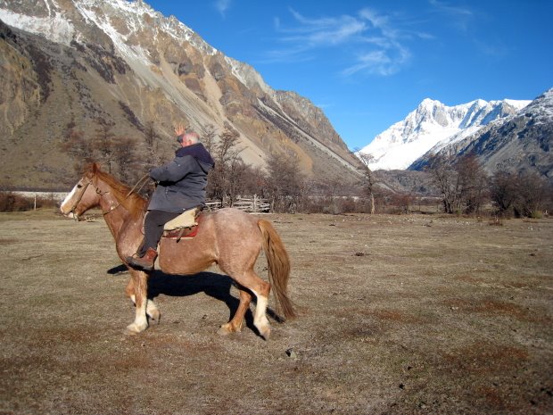
Mario Sar's oldest son (also named Mario) had taken two horses from Estancia Los Ñires to Puesto Muñoz and after a nice beef lunch they rode back to Estancia Los Ñires. We were then left with his youngest son, Martin, and the gaucho Jose Luis, which were both great guys that we had a lot of fun with the following three weeks.
Mario Sar riding back to Estancia Los Ñires. The Rio Oro valley leading to Cerro San Lorenzo is seen in the background.
The next morning we started exploring the approach to the mountain up the Rio Oro valley. We had been warned by Michael Kennedy and Manuel Pedro that the moraine would be dreadful, but luckily they were wrong.......
 A typical scenery at Kullen - rocks with a view!
 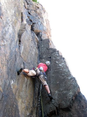 Camilla leading Flagermusen (V+).
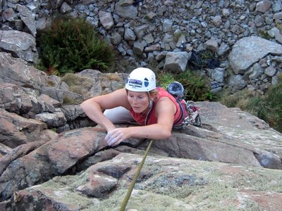 Camilla following on Nirvana (V+).
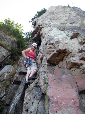 Camilla leading Samsara (V+).
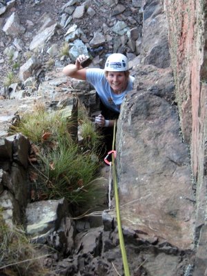 Camilla following on Skidtrenden (V-) with another loose hold in her hand.....
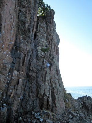 Camilla rappelling Skidtrenden, which is the chimney line left of her.
 A typical scenery at Kullen - rocks with a view!
  Camilla leading Flagermusen (V+).
 Camilla following on Nirvana (V+).
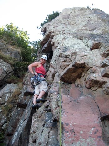 Camilla leading Samsara (V+).
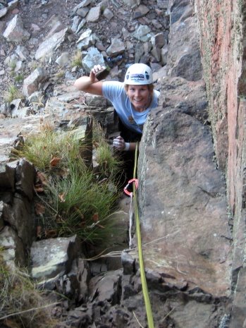 Camilla following on Skidtrenden (V-) with another loose hold in her hand.....
 Camilla rappelling Skidtrenden, which is the chimney line left of her.
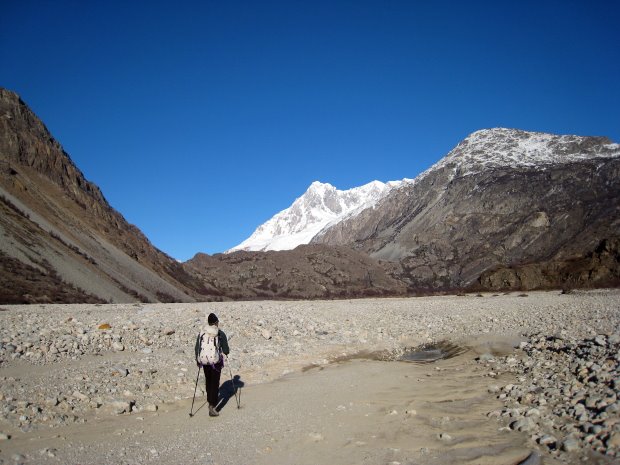
 blog updates